Ocean pollution map · Public beta
See where ocean pollution is heading, before it reaches the coast.
One map for oil slicks, lost shipping containers, derelict vessels, floating debris and algal blooms across the Americas, with a 3-day drift forecast that shows which coasts are likely to be reached.
- 57°S–34°N, 120°W–30°W
- 3-day drift & landing forecast
- Rebuilt when older than 3 h
- Free to use
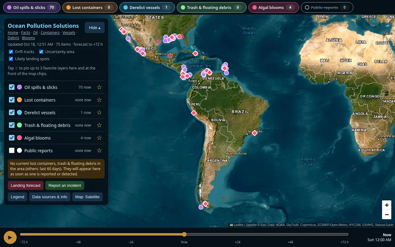
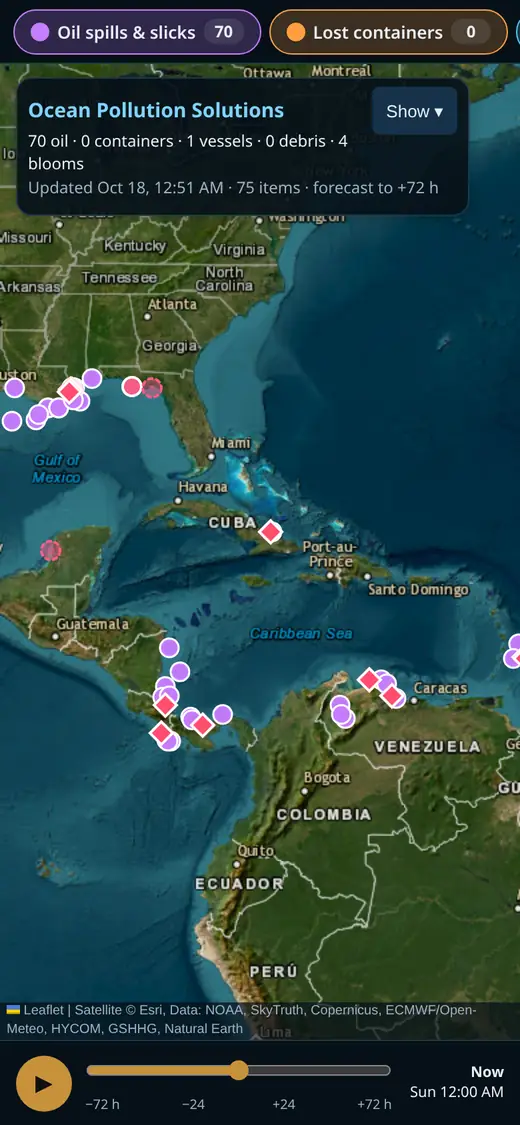
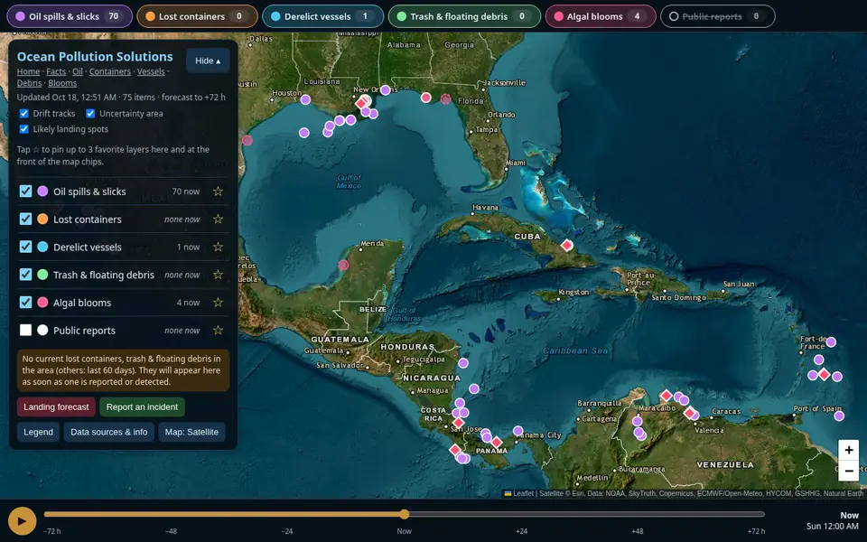
Real screenshots of the map: the Americas (desktop) and the Gulf of Mexico & Caribbean (phone), data of 18 October 2026.Real screenshot of the map on a phone: Gulf of Mexico & Caribbean, data of 18 October 2026.
What it does
Five kinds of pollution, one map, one forecast engine.
Satellite detections, official incident reports and reports from the public are put on one map. Every floating item gets a 72-hour drift forecast with the coast it is likely to reach.
Oil spills & slicks
Possible slicks from satellite radar and official spill reports.
Lost containers
Containers lost overboard: floating or half-sunk hazards to boats.
Derelict vessels
Boats left to drift, sink or rot, that can leak fuel and break up.
Trash & floating debris
Plastic, lost fishing gear and storm debris drifting to shore.
Algal blooms (red tide)
Florida FWC samples and possible blooms from satellite, shown where seen.
Drift forecasts
72 hours ahead, hour by hour on a time slider, with the likely landing place and time for each item.
Incident reports
Signed-in users can report oil, containers, vessels or debris; reports show on the map marked as unverified.
Beach cams
Public beach webcams (USGS CoastCam, WebCOOS) where available, as a visual check of the shore.
How it works
From a satellite pass to a coast forecast, in plain language.
All input data is public. Here is what happens between a detection and the markers on the map.
Find it
Radar satellites (Sentinel-1, via SkyTruth Cerulean) see oil as smooth dark patches on the sea, day or night and through cloud. NOAA analysts' oil reports (NESDIS) and NOAA IncidentNews add official US incidents. Algal blooms come from Florida FWC samples and Sentinel-3 OLCI chlorophyll via NOAA CoastWatch. The public can add reports.
Move it
Ocean-current forecasts (Météo-France SMOC via Open-Meteo, blended with HYCOM and Copernicus Marine where available) carry each item, and the wind pushes it according to what it is: oil, a half-sunk container and a drifting boat each react to the wind differently.
Many runs, not one guess
Each item is drifted several times for 72 hours with slightly different wind and current settings. A track stops at the coastline (GSHHG in the Gulf and Caribbean, Natural Earth elsewhere); the share of runs that reach a coast is shown as its chance.
Check and refresh
The oil drift is re-tuned against repeat satellite sightings of the same slicks. The forecast is rebuilt when it is older than 3 hours; current and wind data are cached for 24 h and 12 h.
Detections from satellites and the public are unverified, and forecasts are automatic estimates, not official advice. NOAA feeds cover US waters only; elsewhere oil comes from satellite radar and public reports. Facts & sources
In an emergency call your coast guard (VHF 16).
Why it matters · Who it's for
Pollution at sea doesn't stay where it was spotted.
Slicks spread, containers and abandoned boats drift into shipping lanes, and debris washes up far from where it was lost. Seeing where it is heading helps people plan before it arrives.
- Coastal & port managersSee which coasts are likely to be reached in the next 3 days.
- Boaters & fishersCheck for possible slicks, containers and derelict vessels before heading out.
- Researchers & NGOsDetections from several public sources on one map, with a shareable bloom file.
- Residents & visitorsKnow what's offshore, and report what you see.
Coverage by region
Gulf of Mexico & Caribbean
Mexico & Central America Pacific
South America: Caribbean & north coast
South America: Pacific coast
South America: Atlantic coast
Open the map
Create a free account or log in.
The live map is free. An account opens it, lets you send reports and keeps your favourite layers on every device.
- Sign up with just an email and password
- We only use your email for your login
- Category pages and facts stay open to everyone